Jl. M.H. Thamrin Kav 3, Menara Thamrin, Level 3A, Jakarta 10250 +62-2139-8303-03 / +62 857 6344 7043 contact@vivoasia.com
Eliasson CBME80B Cloud Ceilometer 1 / 3
Weather & Helideck Monitoring

Eliasson CBME80B Cloud Ceilometer

LIDAR ceilometer reading cloud base to 7,500 m, up to three layers at once, 10-year laser life.

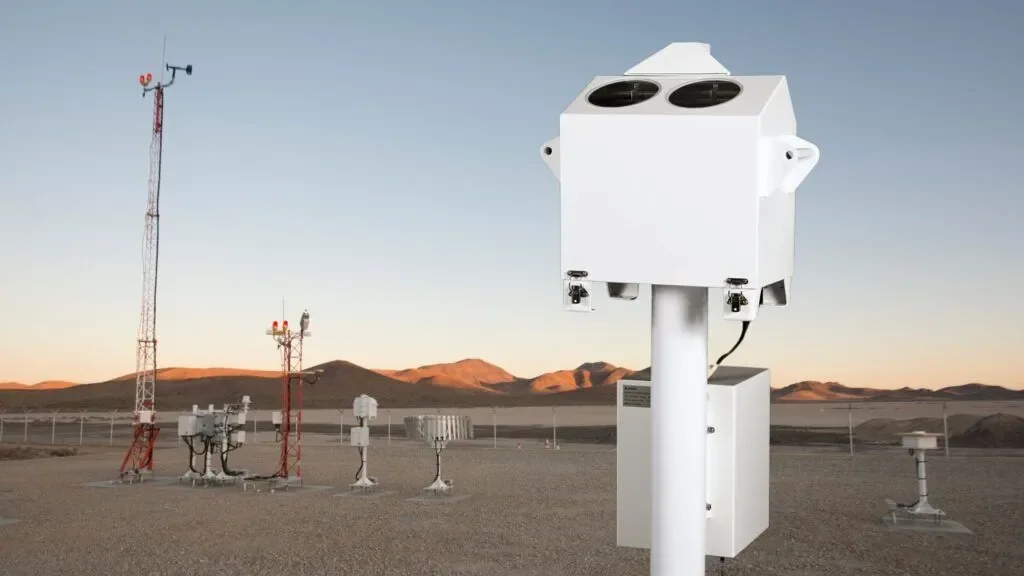
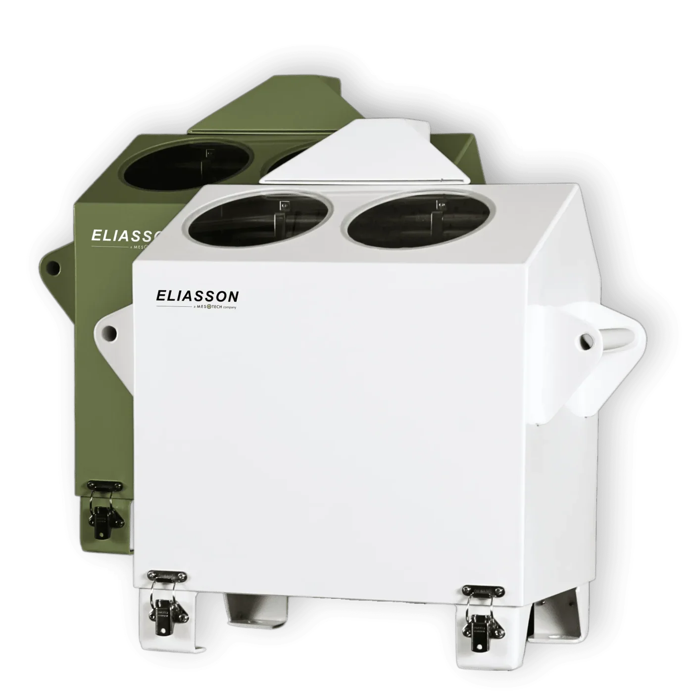
The Eliasson CBME80B is a compact, lightweight standalone ceilometer measuring cloud base height and vertical visibility on the LIDAR principle. It reads 0 to 7,500 m, detects up to three cloud layers simultaneously, and uses an eye-safe Class 1M diode laser rated for a 10-year life.

  • 0 to 7,500 m, resolution 10 m, up to three layers at once
  • Eye-safe Class 1M laser per IEC 60825-1, 10-year rated life
  • Operates from -40 to +60 degrees C; land, ship and offshore use
SPECIFICATIONS
Range 0 to 7,500 m / 0 to 25,000 ft
Resolution 10 m / 30 ft, units selectable
Accuracy Greater of 10 m or 1% of height, against a hard target
Layers Up to three simultaneously
Laser safety Class 1M per IEC 60825-1, 10-year rated laser life

Description

Cloud base height decides whether an approach can be flown. For offshore helicopter operations it is one of the two limiting weather parameters, alongside visibility, and unlike wind it cannot be judged usefully from the deck - a human observer looking up at an overcast sky cannot tell 200 feet from 500 feet, and the difference is operational.

A ceilometer measures it directly using LIDAR. The instrument fires a short pulse of laser light upward and times the backscatter returning from cloud droplets. Because light travels a known distance in a known time, the delay gives the height of the scattering layer. The CBME80B does this with a low-power diode laser whose output is limited to an eye-safe level - formally Class 1M in accordance with IEC 60825-1 - which is what allows an instrument pointing a laser into the sky to be installed on a working deck where people move around it.

It reads 0 to 7,500 m, or 0 to 25,000 feet, at 10 m resolution with selectable units, and accuracy is quoted as the greater of 10 m or 1 percent of height measured against a hard target. Reporting is periodic at a selectable interval from 15 to 120 seconds. Detecting up to three cloud layers simultaneously is more useful than it sounds: real skies are layered, and an aviation report needs to describe the structure rather than just the lowest surface. The instrument outputs cloud height for up to three layers or vertical visibility, cloud amount and sky condition, and its own status.

Vertical visibility is the fallback measurement and the reason a ceilometer is not simply a cloud-base meter. In fog or heavy precipitation there is no distinct cloud base to find, because the obscuration is continuous from the surface upward. In that case the instrument reports how far it can see vertically, which is the parameter an aviation report requires when the sky is indiscernible.

Practically it is a standalone unit weighing 15 kg, running from 115 V or 230 V AC at 45-65 Hz with a 12 V DC option, drawing 30 W for the electronics and up to 200 W for the heater. That heater is the important half of the power budget: optics pointing at the sky collect dew, frost and dirt, and a contaminated window reads as cloud. It operates from -40 to +60 degrees C and interfaces over RS-232 or FSK/V23 - the latter being a modem-style tone signalling scheme that allows the data to travel over an ordinary telephone-grade pair, which is how these get connected on older installations.

Features

  • 0 to 7,500 m at 10 m resolution. Selectable metric or feet, with accuracy the greater of 10 m or 1 percent.
  • Three layers simultaneously. Describes real layered skies rather than only the lowest surface.
  • Vertical visibility fallback. Reports the aviation parameter required when there is no discernible cloud base.
  • Eye-safe Class 1M. Per IEC 60825-1, so it can be installed where people work.
  • -40 to +60 degrees C. With a 200 W heater to keep the optics clear of dew, frost and dirt.
  • Selectable reporting interval. 15 to 120 seconds, periodic.
  • Compact and standalone. 15 kg, no separate processing cabinet required.
  • RS-232 or FSK/V23. Including tone signalling that works over ordinary telephone-grade pairs on older installations.

Applications

Cloud base measurement wherever aircraft operate to a limit.

  • Offshore helideck met stations. One of the two limiting parameters for approach.
  • FPSOs and drilling units. Continuous cloud base reporting for crew change flights.
  • Airports and heliports. METAR and automatic weather reporting.
  • Remote airstrips. Automated reporting where no observer is present.
  • Onshore terminals with helipads. Supporting flights to and from remote facilities.
  • Meteorological networks. Cloud structure as part of synoptic observation.

Support & Documents

PT Vivo Asia Teknologi Indonesia supplies weather and helideck monitoring as an integrated, commissioned system rather than as individual instruments. Our scope typically covers:

  • Selection against CAP 437, the relevant national requirement or your operator's standard.
  • Sensor siting to avoid the structure's own turbulence, exhaust and heat sources.
  • Signal, power and hazardous-area design across the deck and up to the control room.
  • Supply, installation, termination and commissioning.
  • Integration with the helideck monitoring system, status lighting and reporting outputs.
  • Calibration, periodic verification and ongoing maintenance.

Ranges, accuracies, approvals and electrical details vary by variant and are confirmed against the current manufacturer datasheet at quotation stage. Tell us the structure, the standard you are working to and the parameters you must report, and we will come back with a system design and a full bill of materials.

Use the enquiry button above for a datasheet, a specification or a project quotation.

Related products